Beartooth Highway is designated a National Scenic Byway and an All-American Road by the U.S. Department of Transportation. It comprises sixty-eight miles of US 212 through some amazing countryside in southwest Montana and northwest Wyoming. It is considered to be the gateway road to Yellowstone National Park’s Northeast Entrance. The highway was dedicated on June 14, 1936. “Beartooth” comes from the Crow name, “Na Piet Say” for the sharp bear tooth shaped spire at Beartooth plateau, which can be seen at the West Summit pull-out. Beartooth Highway is closed between October and Memorial Day.
Planning a Beartooth Highway Drive
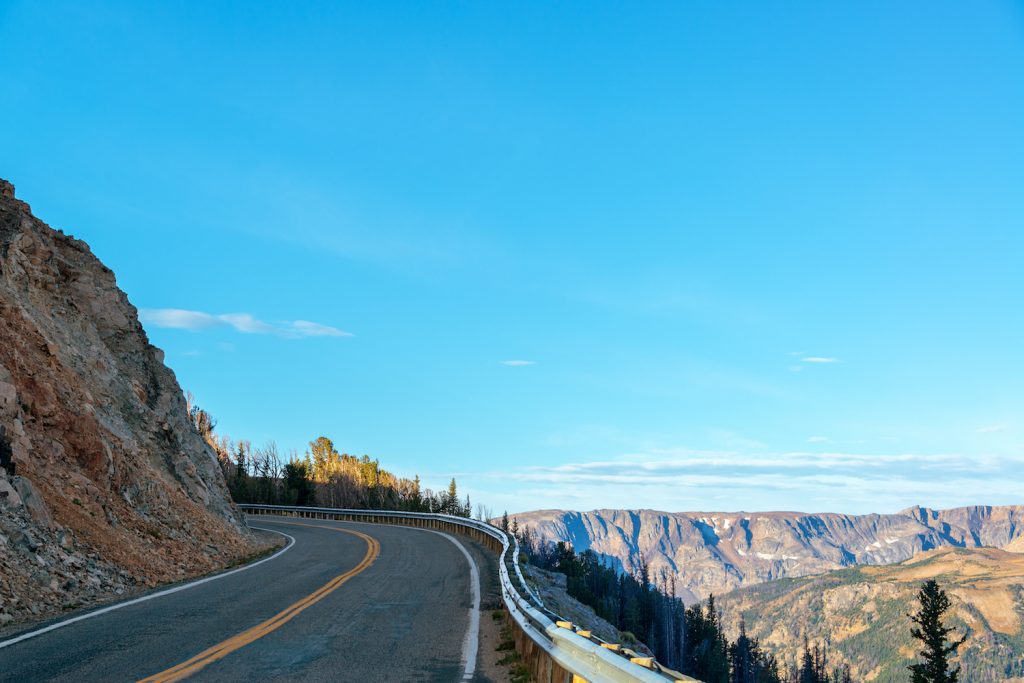
We recommend that you pick a warm and sunny day for this drive so that you can enjoy the scenery at its best, with the dramatic blues of the sky reflected in the waters below. Also, you will enjoy driving on dry pavement. But, if you want a sense of what you missed during the winter, go the very first day the road is open, while huge walls of snow can still be seen on the sides of the road.
There are plenty of pull offs and they are there so that you can stop a savor the various views. The overlooks are planned in such a way that you see portions of the Beartooth country that you would miss if you stayed in your car the entire drive. The added benefit of these pull offs is that you can also allow the impatient driver behind you move along and soon be forgotten. If you plan to stop at each pull-off to see the beautiful vistas along this road, expect your drive to take 3 hours instead of the 2 hours estimated by your GPS device.
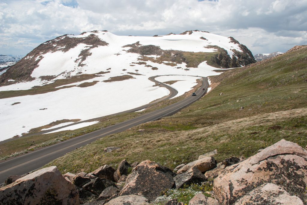
The Beartooth All-American Road passes through what is known as the Beartooth Corridor. You will love the spectacular spectacle of the Absaroka and Beartooth Mountains, the alpine plateaus, glacial lakes, wooded valleys, glistening waterfalls and rare wildlife. Bordered by the Custer, Gallatin, and Shoshone National Forests, running alongside the Absaroka-Beartooth Wilderness, and adjacent to Yellowstone National Park, the Highway is your invitation to million-plus acres of remote wilderness.
The wildlife you may see along the drive includes grizzly bear, grey wolf, moose, mountain goat, and beaver. Wild mustangs are found in the high country; pronghorn antelope are in the plains. It is all part of the Greater Yellowstone Ecosystem.
Along this road you will see twenty mountain peaks that are greater than 12,000 feet high. Granite Peak, with its summit of glacially carved granite, is Montana’s tallest mountain at 12,799 feet above sea level. The Road itself is the highest elevation highway in Wyoming and Montana.
Beartooth Highway Scenic Drive Directions
Begin in the town of Red Lodge, where you can enjoy the Yellowstone Wildlife Sanctuary, home to area wildlife that you can see up close. See the Carbon County Art Guild and Depot Gallery for numerous regional artists, some nationally known. The Carbon County Historical Society and Museum includes exhibits on local history and a model mine. There is a nice gift shop. For a meal in Red Lodge, visit Bogart’s, since 1975, with its eclectic Tex-Mex menu, long bar, tin ceiling, and memorabilia walls (have the Islander Salad), or Café Regis for vegan fare.
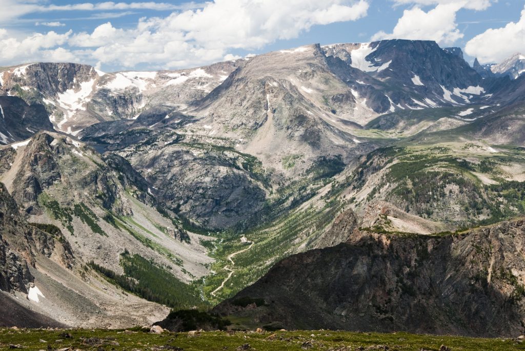
Then head out on US 212. You will pass the Inn on the Beartooth B&B with real Montana flavor, from the log walls to the huge stone fireplace, and incredible views. Drive through Howell Gulch. The Two Bears Inn is a great bed and breakfast, with a cabin separate from the lodge for your get away.
Beyond Twin Elk, you will come to the Westminster Spires Camp, a ministry of the Yellowstone Presbytery of the Presbyterian Church (USA). This beautiful camp provides a traditional camp experience along the shore of Rock Creek and at the base of Westminster Spires. Check with them for opportunities to visit and stay at the camp.
Next comes the Bear Track Trailhead. Remember if you do take a hike, to be bear-prepared. As you drive along you will encounter dramatic switchbacks, daring turns, and incredible views—none of which are for the faint of heart. Be sure to give yourself a change of pace, stopping at the scenic turnout at Rock Creek Vista, with its views of Rock Creek Canyon as well as of Hell Roaring Plateau. The short trail to the overlook is wheelchair accessible.
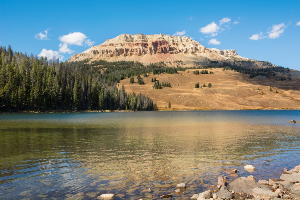
Next, you will cross over the Montana Wyoming state line. These alpine meadows make you feel as if you are on top of the world. And just to prove it, you will come to the Top of the World Store and Motel, where you can shop for groceries, souvenirs, books, maps and gifts. Continue along to the always-photogenic Beartooth Lake, whose waters are a perfect mirror reflecting impressive Beartooth Butte.
At Lake Creek, take the short path back to the lake. The old historic Lake Creek Bridge was completed in 1932 by the WPA (Work Project Administration). It is among only a few structures from the original road. The granite rocks were hewn with chisels for a snug fit. Crazy Creek is named for its zigzag course down the mountainside. Enjoy the lovely Crazy Creek Falls. Next you will re-cross the Wyoming Montana line. If you plan ahead and bring a picnic, a great spot to enjoy it is the Clarks Fork picnic area.
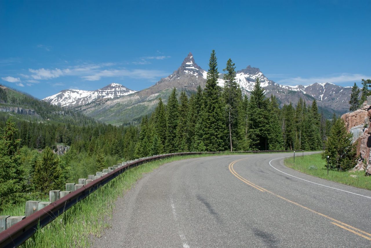
The Clark’s Fork River creates the Clark’s Fork Valley named by Meriwether Lewis in honor of William Clark on their westward expedition. Pilot Peak and Index Peak, towering above Clark’s Fork Valley, are the most photographed mountains on the Beartooth Highway. Visitors frequently mistake Pilot Peak for the “bear’s tooth”.
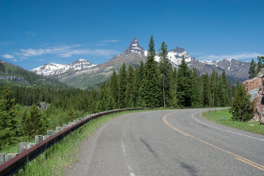
Index and Pilot Peaks
Conclude your drive at Cooke City. Like everyone who comes here, visit the Cooke City General Store, dating back to 1886. Stop at the Yellowstone Trading Post, too for a little bit of everything. For a meal made from scratch, try Cafe Cooke. For the best breakfast in town, it’s the Bearclaw Bakery. Delicious dinners await at Beartooth Café. For pizza, it’s Miners Saloon. Now you have completed the Beartooth Highway, and arrived at Yellowstone National Park.

