
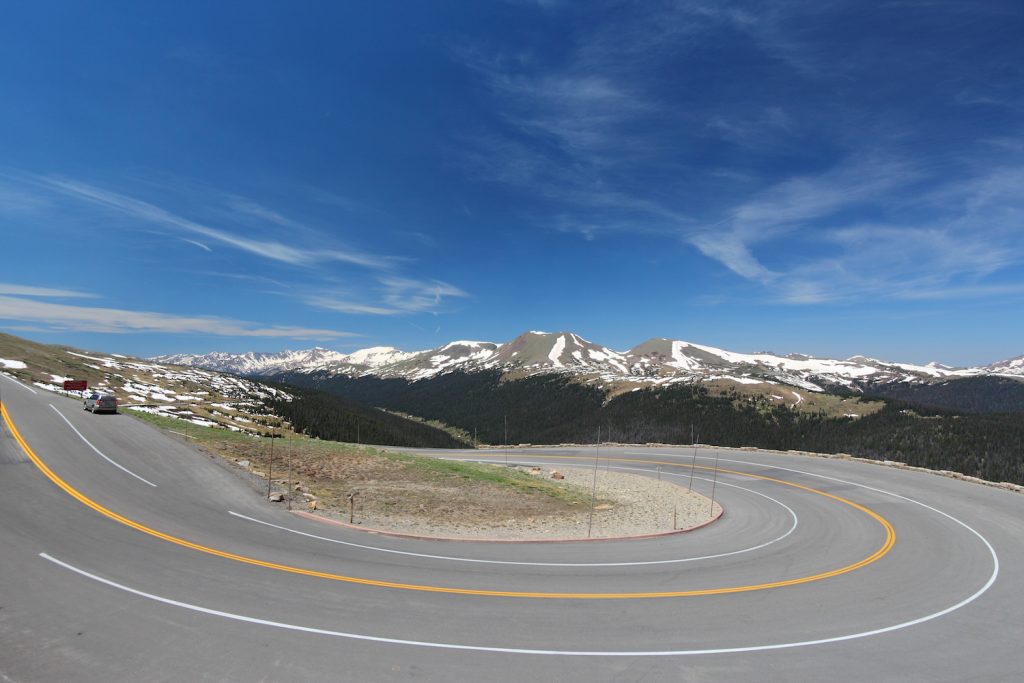
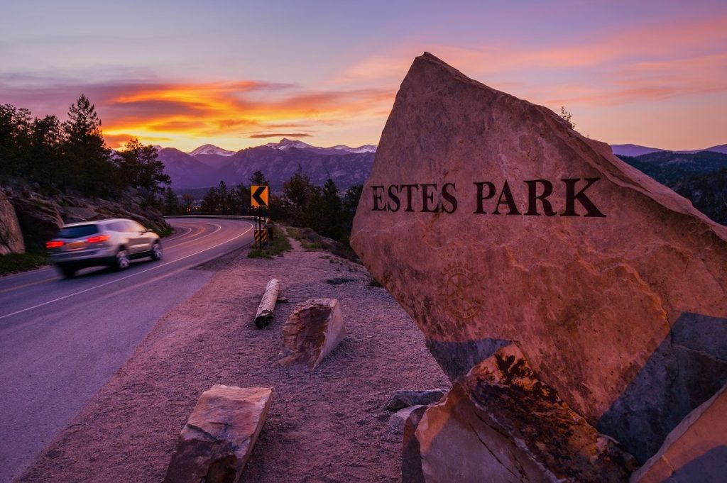
If you want to drive to places that normally only the most rugged terrain hikers can visit, then Trail Ridge Road is for you. It is a stretch of U.S. Highway 34 that takes you through the Rocky Mountain National Park from Grand Lake, Colorado, in the west to Estes Park, Colorado in the east. The route is about 48 miles long, and takes you 12,000 feet high. To drive it, you will have to pay the National Park entry fee, but it is worth every dollar. The Trail Ridge Road offers hairpin turns, sweeping views, spectacular landscapes that include tundra and Alpine plants. Perhaps the greatest thrill is the eleven-mile stretch on top of the world, as you drive above the tree line. It is the highest continuously paved road you can drive in all of North America.
[flexmap id=’2′]

Wikipedia user Jay Erikson, via Wikimedia Commons
Begin in the town of Grand Lake. It serves as the western gateway to Trail Ridge Road and to Rocky Mountain National Park. You may wish to visit Adams Falls, reachable by a hike on a short trail in the Grand Lake area.
Be sure to stop at the Kawuneeche Visitor Center. At the visitors center you can buy a small book titled “Guide to Trail Ridge Road”, that provides an overview of what you will see at each scenic stop. A bit west of the visitor’s center, the Winding River Resort has several lodge rooms as well as campsite rentals.. As you continue on Trail Ridge Road you will enjoy the juxtaposition of the Lodgepole Pine forests and river views as you travel up the Kawuneeche Valley. The Harbison Picnic Area gives a great view of the broad meadow, often visited by elk.

“Colorado River in Rocky Mountain NP” by Hogs555 – Own work. Licensed under CC BY-SA 3.0 via Commons.
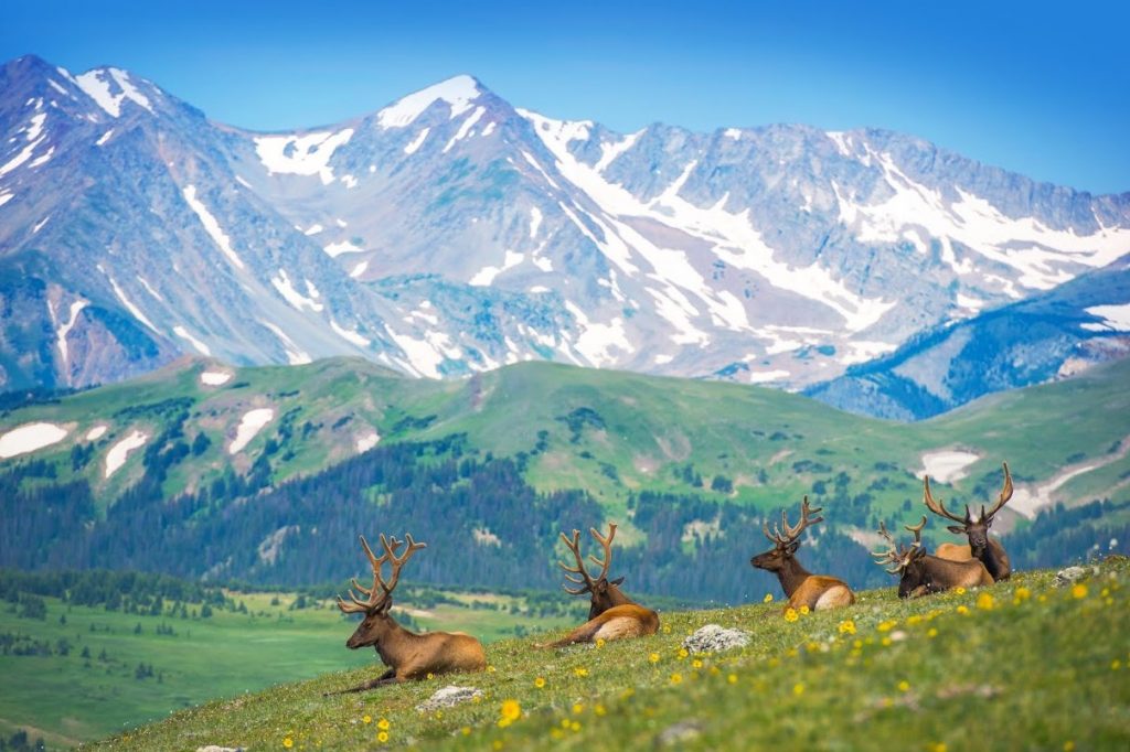
The Green Mountain Trailhead is a developed trailhead on the east side of Trail Ridge Road. It is an easy 1.8 mile hike in, and the same back. Once you get to the Big Meadow, the trail ends and you are on your own. The meadow is the ideal habitat for elk, deer and moose and it is one of the Park’s best year-round wildlife viewing locations.
Coyote Valley Trailhead. Is only a 1 mile loop, offering a short, easy hike for families. It is a flat trail that crosses a small bridge over the little stream that is the beginning of the Colorado River and then follows its shoreline through a meadow in the Kawuneeche Valley. There are picnic tables, but not much shade on this hike. You will pass Timber Creek Campground, one of several in the park, situated in a broad valley.

“Castle Cabin, Holzwarth Historic District” National Park Service webpage. Licensed under Public Domain via Commons.
At the Holzworth Historic Site you can take a short stroll that leads to a bridge over the Colorado River and to an old trout fishing camp, where there are plenty of ranges on duty to interpret this cluster of cabins. An added treat, you can try on all kinds of vintage clothes, including some giant looking bison hide coats. Families enjoy learning what life was like in this area a hundred years ago.
As you continue to climb Trail Ridge Road you arrive at the Fairview Curve Viewpoint. Stop to see where you have been. From this vantage point you can look down into the valley to see the narrow, twisting Colorado River. By the way, the source of the Colorado is just above the Kawuneeche Valley, in the Never Summer Mountains.
.jpg)
By Sayamindu Dasgupta from Cambridge, MA, United States, via Wikimedia Commons
At Medicine Bow Curve you have reached 11,640 feet. Stopping to look northward, you can see the Medicine Bow Mountain Range (about 20 miles away); and Wyoming (about 35 miles away). To the west are impressive mountains including: Baker Mountain (elevation 12,397), Mt. Nimbus (elevation 12,706); Mt. Cumulus (elevation 12,725), and Howard Mountain (elevation 12,810)
Alpine Visitors Center, at 12,000 feet, is the most extensive of the visitor centers in the Park, offering, restrooms, a shop with gifts including a Native American section of arts and crafts, and the Alpine restaurant. There are great photo ops from the patio; you can see the Glacial Cirque, a U shaped curve formed by ancient glaciers. Explore a bit by taking take the stairs beside the visitors center to take in the views from that vantage point. The Trail Ridge Road Summit is located between the Alpine Center and the Lava Cliffs Overlook, where you have views of cliffs that are estimated to be 25 million years old. Iceberg Pass is both beautiful and otherworldly, as you savor your drive at what seems the top of the world.
Stop at the Tundra Communities Trailhead and stroll to the end of the short trail for the views. Then when you continue on your way you will almost immediately drive through dramatic Rock Cut. At Forest Canyon Overlook take the short stroll to a nice rounded viewing point. Rainbow Curve Overlook offers views of Never Summers Mountains to the west. At Many Parks Curve Overlook, a nice walkway connects the parking areas and provides views of the valley.
Beaver Ponds Pull Out has the Beaver Ponds Boardwalk, a short out and back trail that features a river. The trail is good for all skill levels. Deer Mountain Trailhead offers a strenuous but do-able summit hike with incredible views. As you depart the park, stop at the Beaver Meadows Visitors Center, which dates to 1965 and was designed by architects of Frank Lloyd Wright’s Taliesin firm. Savor that you have just enjoyed some of the most stunning views of the American Rockies.


