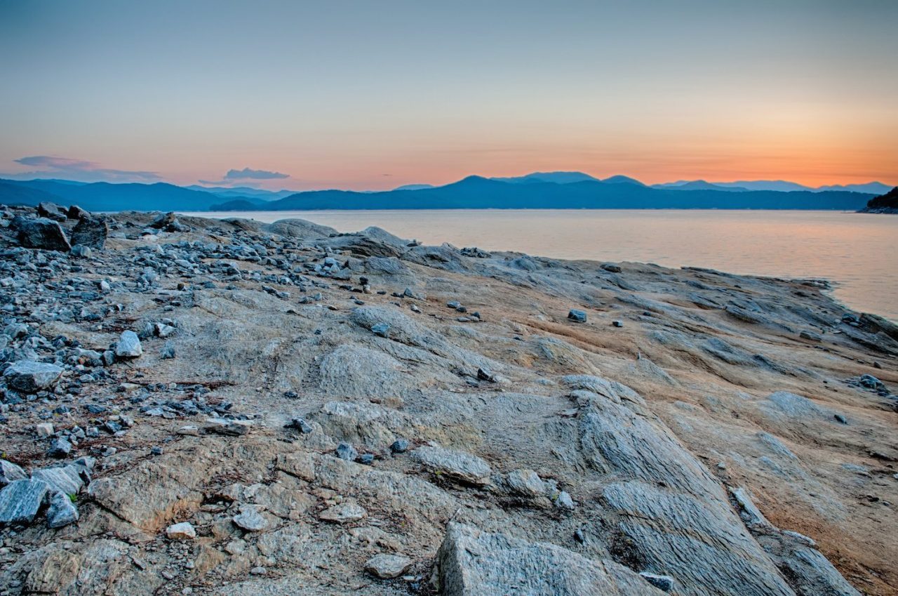
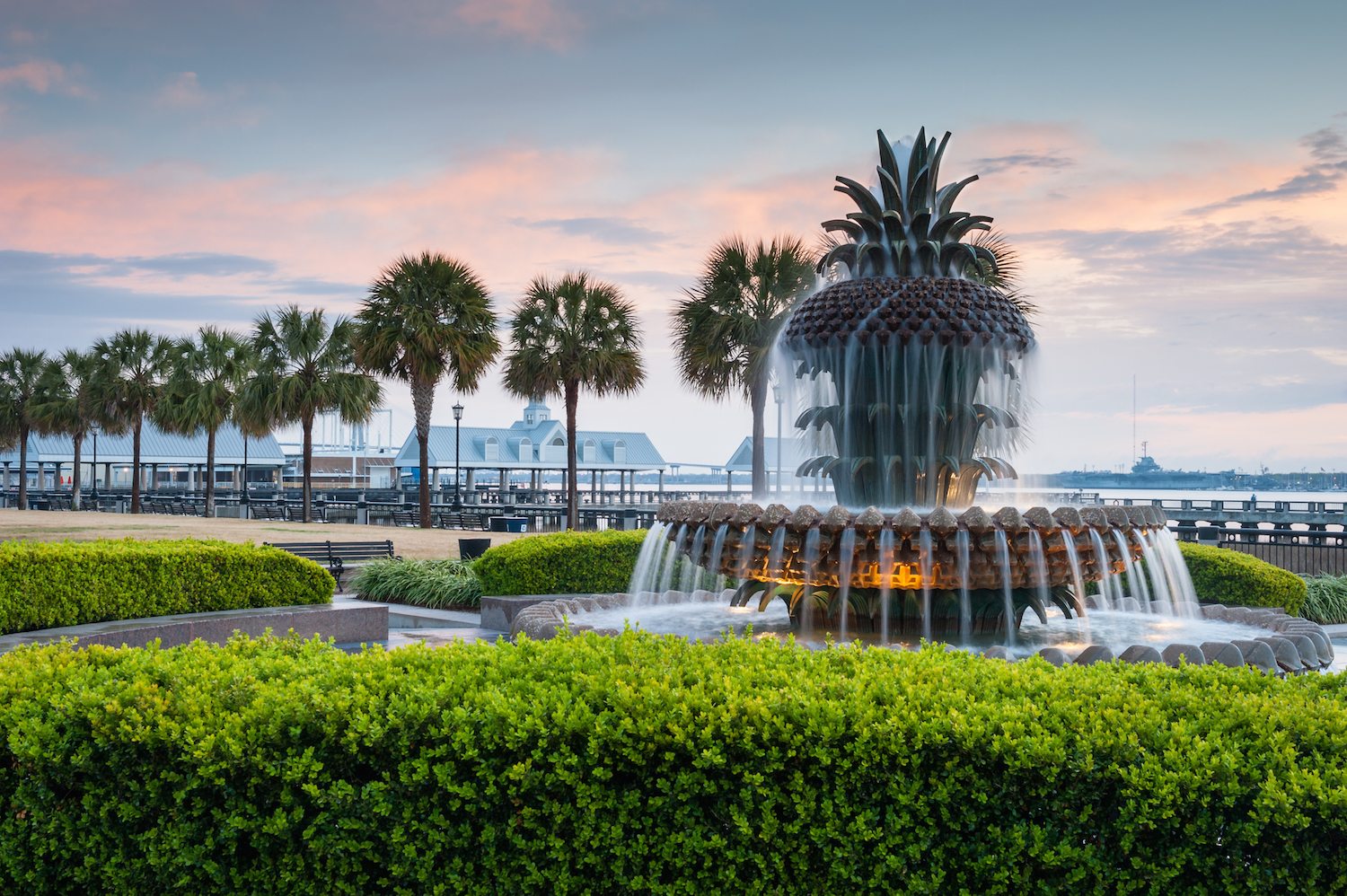
The Cherokee Foothills Scenic Highway is consistently rated one of the top drives in the USA and perhaps one of the top three east of the Mississippi. It traverses the Upcountry of northwest South Carolina, in the foothills of the Blue Ridge Mountains. This 118 miles long road winds, dips, curves and climbs following a route first used by the Cherokees, once known as the “Kewowee Path”. What makes the Cherokee Foothills Scenic Highway special? Try the beautiful state parks, the dramatic waterfalls, the historic battlefields, the fabulous fruit stands, the super hiking, white water rafting, and the quaint towns.

By Clemson3564 (Own work) via Wikimedia Commons
 We suggest you start at the western end and travel eastward. Or just start at the end of this article, and drive the other direction. Begin at the South Carolina Welcome Center at Fair Play, right where I-85 meets highway 11. Be sure to tell them you are taking the scenic byway, and they will have a map and many other helpful tips to share with you. You will soon come across Lake Hartwell State Park, an immense body of water, which is popular for swimming, boating and other water activities. You can enjoy a picnic area and walking trails as well. Westminster is a town blessed by charm galore, with its main shopping street and leafy residential neighborhoods filled with historic buildings such as the Westminster Presbyterian Church. Step back in time at The General Store Museum to see a collection of artifacts from the historic England’s General Merchandise store of Westminster. In and around Westminster, Brasstown Falls, Chau-Ram Falls and Riley Moore Falls are lovely and picturesque. Also worth a photo op is the old Tugaloo River Bridge, called the Broken Bridge, west of town. Westminster is famously the home of the Apple Harvest Festival the weekend after Labor Day.

By ТимофейЛееСуда (Own work) [CC0], via Wikimedia Commons
At West Union go left into Walhalla, the seat of Oconee County, whose means “Garden of the Gods”. Stroll the town and visit the Oconee Heritage Center, explore the history of Native Americans, Immigration, Railroads, New Deal Programs, Textile Mills, Agriculture and much more as it relates to Oconee County. The Old St John’s Meetinghouse and the Oconee Station figure among the historic buildings here. Nearby is the Stump-House Tunnel, a railroad tunnel that was hand dug in the Civil War era. In 1951, Clemson University bought the tunnel and used it to cure the South’s first blue cheese. While there you can also see Issaquena Falls, the largest in SC. Waterfalls in and around Walhalla include Lee Falls, Station Cove Falls and Kings Creek Falls. The city of Clemson is a short detour eastward, where you can see world famous Clemson University, Ft. Hill the mansion of John C. Calhoun, and enjoy the lovely South Carolina Botanical Gardens.

By blahedo, via Wikimedia Commons
When you come to Devils Fork State Park you may wish to take route 107, another scenic byway that traverses Sumter National Forest. And from here you can make a nice side trip to the wonderful city of Asheville NC if you have the time and inclination. Continue on the Cherokee Foothills Scenic Highway to the small town of Salem, “The Diamond of the Upstate” that serves as the gateway to Lakes Keowee and Lake Jocassee. Sunrise Farm Bed & Breakfast at Salem is an 1890s farmhouse with self-contained cottages, and a farm animals petting zoo. We recommend Keowee-Toxaway State Park’s a museum interpretive center and trail that describes the history of the native people who lived here before Europeans arrived.

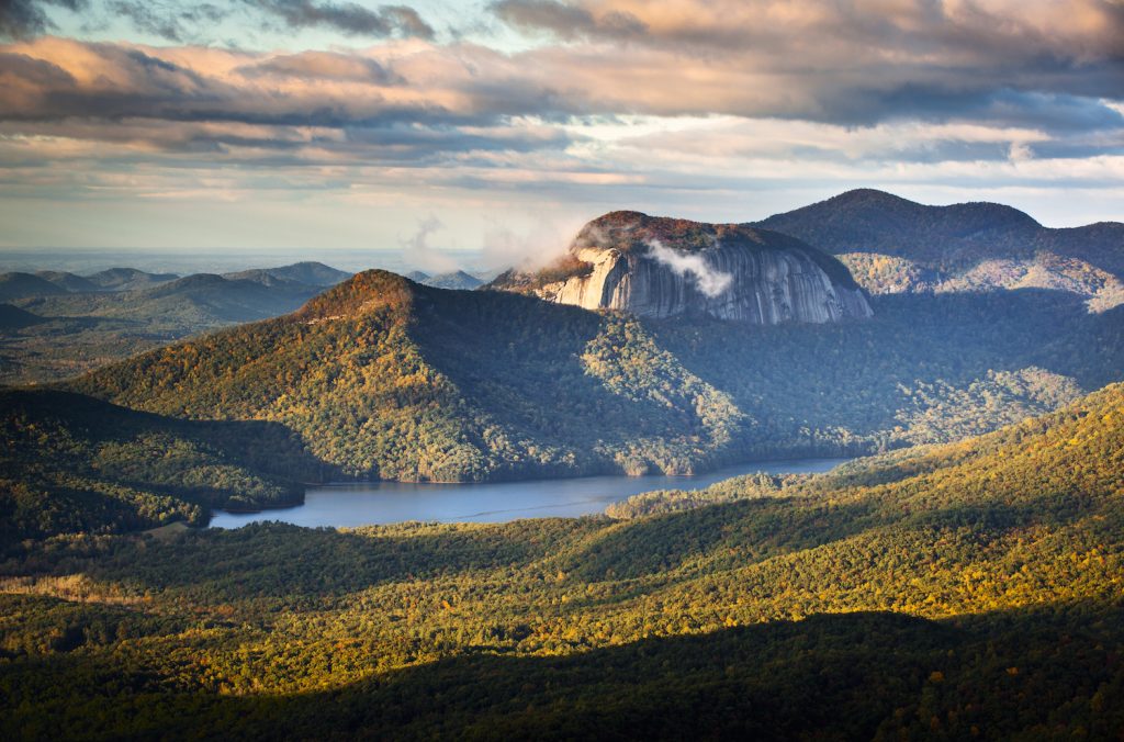
At Table Rock State Park – named for the flat top mountain that the native people called the place where the Great Spirit dined – you can also see a vintage lodge built by the Works Project Administration in the 1930s. Take a trail leading to the top of the mountain, or visit the waterfalls. A fun short hike is the Carrick Creek Trail, about two miles of a loop around the Nature Center. It is great for hiking with young children, because there are waterfalls galore. Near Table Rock, rustic Aunt Sue’s Country Corner has gifts shops and ice cream.

Table Rock Mountain By Clemson3564, via Wikimedia Commons
Visitors rank Caesars Head State Park as among this area’s finest, with gorgeous views, and Caesars Head offering a great vantage point of Table Rock Mountain. As you drive to the park you will have view after view of the foothills. There are numerous waterfalls here too, and you can take the tow mile hike to Raven Cliff Falls to see a 400-footer in a scenic gorge. Gowensville is the principal town in what is known as the Dark Corner of South Carolina. You will want to see Campbell’s Covered Bridge, built in 1909, the last remaining covered bridge in South Carolina, nearby. Campobello is the home of several Victorian era homes of distinction. In Chesnee, The Bantam Chef has been a local institution since 1964; go for the burgers and the old time atmosphere. Other dining options in Chesnee include highly popular Strawberry Hill for the cats head biscuits (they are that big).
Cowpens National Battlefield takes you all the way back to the American Revolution where our forces under Daniel Morgan achieved an upset victory over the British troops which was the turning point of the War in the South. The Visitors Center has a small museum and an excellent interpretive film. Take the easy walking tour and soak in some great history. If you have been feeling shopping deprived on your scenic drive, no worries, you will find more premium outlets than you could imagine at Gaffney, which is the end of the Cherokee Foothills Scenic Highway. To celebrate, have a photo taken with the oversized peach known as the Peachoid Water Tower, and have Sonny’s Donuts make a customer filling and frosting doughnut, just for you!
